


Building Africa's Next Drone Workforce: A Q&A with Palesa Thetele.
Posted by Pauline Omagwa • Oct. 20, 2026
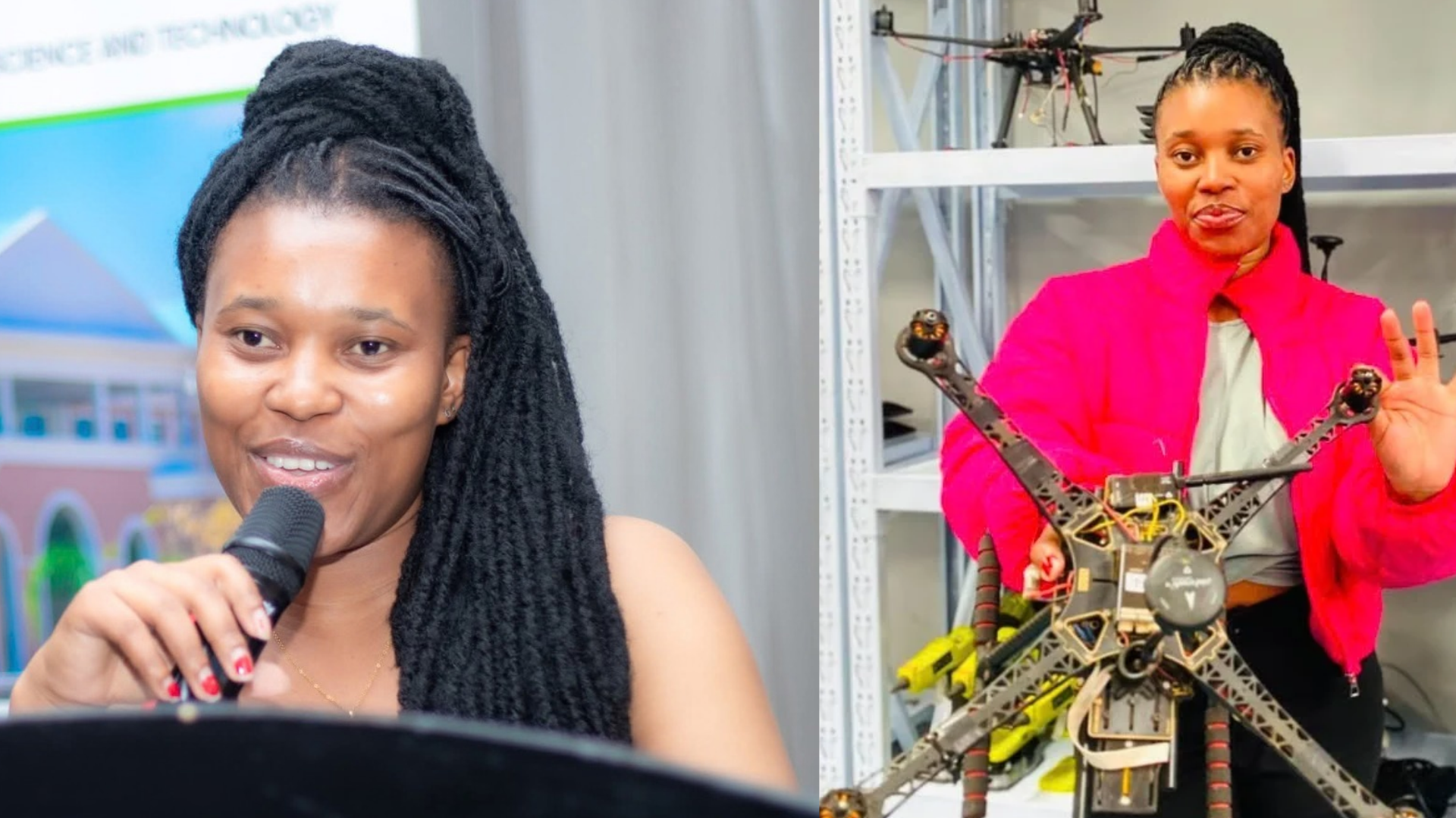
Africa has fewer than 5,000 certified drone pilots. Palesa Thetele, a computing graduate from Botswana, is now one of them.
Palesa joined an intensive residency at the African Drone and Data Academy, based at the Malawi University of Science and Technology. She started with zero flight hours. She finished with three remote pilot certifications after using drone mapping, GIS, and AI to tackle public health challenges.
Her training is part of Design Thinking for Drone and Data Technology for the Youth Force. The initiative is building a new generation of certified youth drone mappers. It brings together the Humanitarian OpenStreetMap Team (HOT), UNICEF, the African Drone and Data Academy, Generation Unlimited, the Lesotho Aviation Authority, and Yoma.
We spoke to Palesa about her background, the training, and how she plans to use spatial data to solve problems at home.
What is your background, and how did you first hear about this training?
Palesa Thetele: "I'm a computing student and recently graduated from university with a first-class degree. I do both software and networking. I'm really interested in technical fields. Anything tech, I want to explore and learn about.
I came across the opportunity through LinkedIn. A friend had mentioned the Humanitarian OpenStreetMap Team (HOT) before; they're very much into GIS and mappings, but coming from technology, I didn't know much about that side of the field. When I saw the post, I said, 'This is my chance to explore and learn.'"
What was the selection process like for getting into the residency?
Palesa Thetele: "For the first cohort, we were about 60, and then you had to qualify for the next cohort, which only took 16 of those 60. That's where it gets very hectic. They prioritized girls, so about 60% of us were girls. They are trying to create more chances for us."
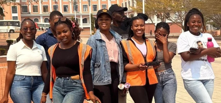
Palesa's residency cohort at the Malawi University of Science and Technology | Photo: courtesy of Palesa Thetele
Tell us about the project you worked on during the residency.
Palesa Thetele: "Our team came from entirely different backgrounds. I was from computing, and I had fellows from agricultural engineering, environmental health, and environmental science. We approached the same problem from different perspectives to develop a solution.
Our project focused on cholera risk factors in the Nsanje district in Malawi. We explored how drone imagery, GIS, and artificial intelligence could combine to identify and prioritize environmental factors that raise risk. Malawi experiences floods and cholera outbreaks frequently, so we applied what we were learning to come up with solutions."
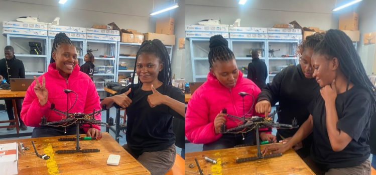
Palesa (left, in red) and a fellow trainee assemble a drone at the African Drone and Data Academy, Malawi | Photo: courtesy of Palesa Thetele
What did this opportunity mean to you personally?
Palesa Thetele: "This position was a giant opportunity, and I was very honored. Being chosen showed my resilience and hard work, because even with their focus on women, you still had to qualify.
Most of us tend to think this is a male-dominated field. Having them give us a platform to prove ourselves, to show that even we can survive in such an environment, is both challenging and exciting. It shows that beyond gender, I can do this."
How do you plan to use these skills now that you are home?
Palesa Thetele: "I want to continue combining my computing background with geospatial technologies and AI to work on practical problems in public health, climate resilience, and community development.
During my undergrad, I was working on a TB detection project using AI focused on rural, hard-to-reach areas where we needed information. Now I know we can use drones to get that spatial data and do deliveries. I can confidently say, 'For this problem, this is the solution.'"
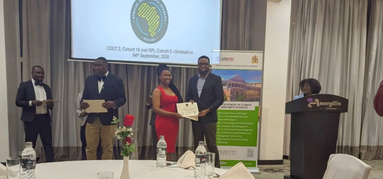
Palesa receives her certificate at the graduation ceremony in Malawi, 4 September 2026 | Photo: courtesy of Palesa Thetele
How do you plan to use these skills now that you are home?
Palesa Thetele: "I want to continue combining my computing background with geospatial technologies and AI to work on practical problems in public health, climate resilience, and community development.
During my undergrad, I was working on a TB detection project using AI focused on rural, hard-to-reach areas where we needed information. Now I know we can use drones to get that spatial data and do deliveries. I can confidently say, "For this problem, this is the solution."
About the project
Design Thinking for Drone and Data Technology for the Youth Force is a partnership between HOT, UNICEF, the African Drone and Data Academy at the Malawi University of Science and Technology, Generation Unlimited, the Lesotho Aviation Authority, and Yoma.
The program builds a job-ready pipeline of certified youth drone mappers across Lesotho and South Africa. Participants take part in design thinking workshops, assemble low-cost drones, fly field missions, and process spatial data using QGIS and OpenDroneMap. All graduates receive verified digital credentials on the Yoma platform.
A parallel track trains public sector officials. They learn the regulations, champion spatial data, and formally commission youth-led drone mapping services. This helps trained mappers move straight into work.
Share